OUR PHILOSOPHY
 The Otay Water District is committed to conducting our business in accordance with all applicable environmental laws, regulations, and permits and to protecting the rich and varied environmental resources within our boundary.
OTAY WATER DISTRICT ENVIRONMENTAL PROGRAM
The District has a comprehensive environmental program that is proactive in response to environmental compliance and protection of public resources. The District is located in an area of high environmental sensitivity. There are many areas within our 125 square miles of service area that are undeveloped and contain significant environmental resources. All of our construction projects and on-going activities are subject to environmental scrutiny. The following components of our environmental program are described in detail below:
Planning Process and Related Documents
NCCP/HCP Subarea Plan
San Miguel Habitat Management Area
PLANNING PROCESS AND DOCUMENTS
The District’s comprehensive planning process ensures compliance with environmental regulations. There are several important documents which set forth the District’s planning and associated environmental efforts. These documents are the Water Resources Master Plan (WRMP) and its Programmatic Environmental Impact Report (WRMP PEIR).
The Otay Water District's Water Resources Master Plan (WRMP) outlines a comprehensive program for the orderly and phased development of potable and recycled water supply, storage, transmission, and distribution through ultimate build out of the land within the District, according to local land use approvals and planning. The projects in the WRMP consist mostly of pipelines, reservoirs, and pump stations that are needed based on population projections, District criteria for the adequacy of facilities, and specific project development plans in the District's service area. District planning is dynamic, and land use decisions by local jurisdictions (the city of Chula Vista, the city of San Diego and the county of San Diego) affect the size, location, and even the need for District facilities. The District's planning is continually being adjusted for such factors, and the WRMP is formally updated at five to seven year intervals to reflect the most current land use information. The most recent update was completed in 2009 by the engineering firm, PBS&J. In conjunction with the preparation of the latest WRMP, a Programmatic Environmental Impact Report (WRMP PEIR) was prepared, also by PBS&J. The WRMP PEIR considered the potential environmental effects of implementing the WRMP. This document sets the criteria for the mitigation of impacts that could be reasonably anticipated for each of the projects and identifies the need for further studies where applicable. The issues examined in the WRMP PEIR included land use, noise, geology and soils, paleontology, biology, archaeological and historical resources, land form alteration and aesthetics, public safety and circulation, air quality/climate change, and water resources. For projects specifically identified as within its scope, the WRMP PEIR will be used by the District to streamline environmental review.
NCCP/HCP SUBAREA PLAN
 The District is in the process of developing a Subarea Plan that will be incorporated into a Natural Community Conservation Plan / Habitat Conservation Plan (NCCP/HCP) that will cover the biological impacts associated with the District’s facility construction and operation and maintenance projects. The District’s Subarea Plan will conserve the sensitive species and their habitats within its boundary while allowing for the appropriate growth, operation, and maintenance of the infrastructure needed to supply safe and reliable water to customers. The NCCP/HCP process allows habitat conservation planning to occur at a local level in accordance with state and federal laws that protect endangered species. The federal and state regulations provide overarching policies to conserve and manage ecological communities, but it is up to local jurisdictions and agencies to find solutions at a regional and sub-regional level. The development of the Subarea Plan will allow the District to manage the land within its boundary for conservation and to benefit wildlife resources and habitat while continuing to use the same lands for water resources and the protection of drinking water supplies. Upon completion of the Subarea Plan, the District will become one of the partners in the Joint Water Agencies (JWA) NCCP/HCP. The other three members are Helix Water District, Padre Dam Municipal Water District, and the Sweetwater Authority. The JWA is working to identify valuable resources for conservation in the southern part of the County. The water districts already protect and manage public lands within watersheds. The districts are coming together to provide additional management to protect threatened and endangered species and the habitat they depend on. Conservation requires cooperation between agencies such as the California Department of Fish and Game, the U.S. Fish and Wildlife Service, environmental groups, and concerned citizens. In the case of Otay Water District, coordination with other water districts in southern San Diego County will serve to strengthen regional conservation planning efforts while also ensuring an efficient process for essential projects and water operations. The JWA aims to create a comprehensive and beneficial conservation program by building on existing knowledge about sensitive biological resources and the regional preserve system. The District’s plan will be designed to complement and reinforce the JWA NCCP/HCP as well as regional conservation efforts, including the San Diego Multiple Species Conservation Plan and other conservation plans in the San Diego area.
SAN MIGUEL HABITAT MANAGEMENT AREA
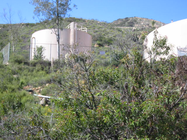
 The District maintains the San Miguel Habitat Management Area (HMA), a biological reserve of more than 230 acres, created and designed by the District as a reserve and mitigation bank on lands of very high biological value within the District""s Wastewater Reclamation Use Area. The Use Area is on the slopes of Mother Miguel Mountain and San Miguel Mountain south of Sweetwater Reservoir. The HMA supports coastal sage scrub, coastal California gnatcatchers, and numerous other sensitive plant and animal species. The District's San Miguel HMA is a major contributor to habitat preserve planning efforts in the Otay-Sweetwater area. Preserved and managed under a Section 7 agreement under the Federal Endangered Species Act with the U.S. Fish and Wildlife Service, the HMA is also the cornerstone of the District's preservation and mitigation policy as expressed in the District's Subarea Plan. The HMA is used by the District as a "bank," storing credit to be used for the mitigation of impacts caused by District projects.
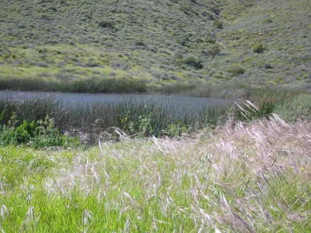
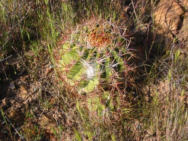
The HMA has several specific conservation areas within its boundaries, including the Rickey Pond wetlands area, the native grasslands and burrowing owl area, and the maritime succulent scrub area. Some of the sensitive biological resources found within the HMA include the California gnatcatcher, least bell’s vireo, western burrowing owl, San Diego barrel cactus, and the Otay tarplant. The District has a history of environmental stewardship and protection of these and other sensitive biological resources. The San Miguel HMA is a cornerstone of the District’s preservation and mitigation policy which will be detailed in its pending Subarea Plan.